Bustime
Service to assist users in planning their trips
Description
Bustime is a convenient service that helps you track public transport in real-time. We provide accurate information about the location of buses, trams, and other types of transport to make your travel more comfortable and predictable.
Our service operates in various countries around the world. We provide accurate data on urban transport movement, helping thousands of users save time and avoid long waits at stops.
Our mission
We strive to make urban transport more accessible and convenient for everyone. Our goal is to reduce waiting time at stops and help you better plan your routes.
Why choose Bustime?
- Real-time: we show the exact location of transport and the estimated arrival time.
- Intuitive interface: our service is easy to use both on a computer and in a mobile application.
- Global reach: Bustime operates in many cities worldwide and continually expands its coverage.
- Regular updates: we continuously improve our technologies to provide only up-to-date data.
Busti.me site
A solution that doesn't require installation, which in a few clicks will show where your bus is. All the necessary information to help you understand if you can catch your bus.
On the main page, just click on the desired tile with your route, and you will see two columns with direction stops where active buses are marked. Opposite each stop, there is the arrival time of the nearest bus.
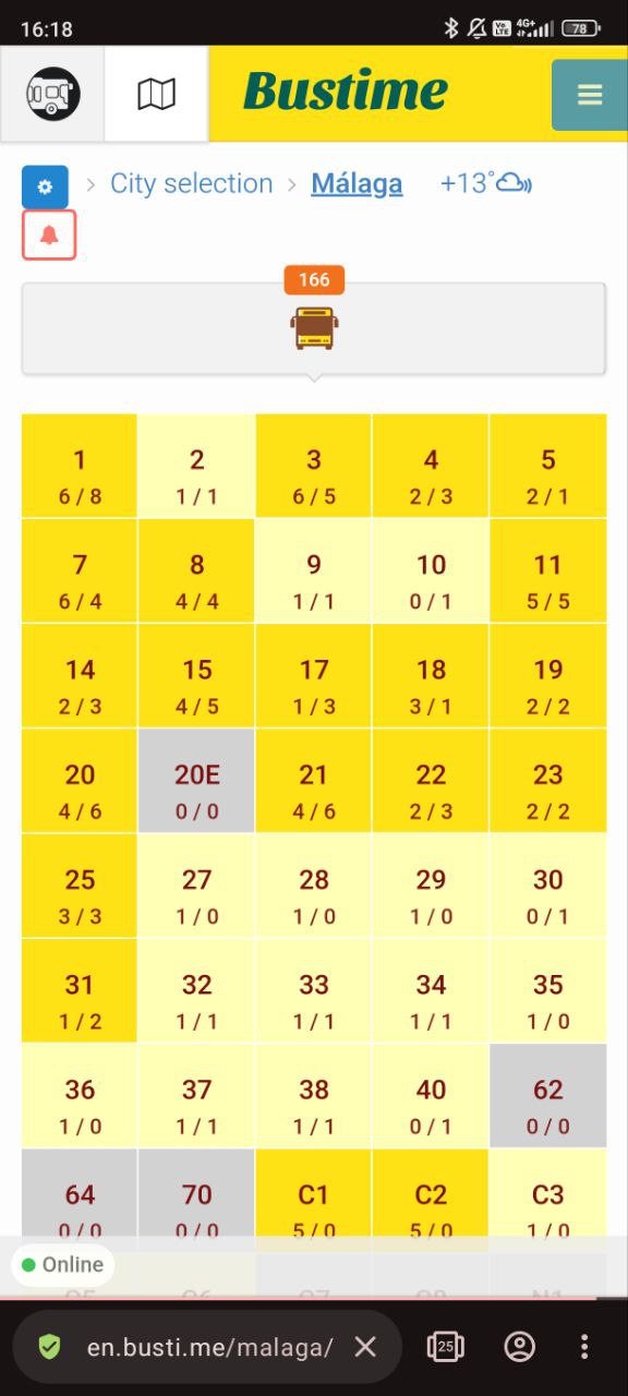
Route grid
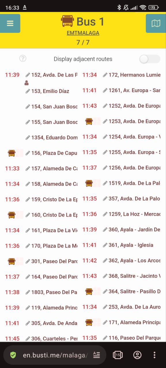
Pleasant route interface
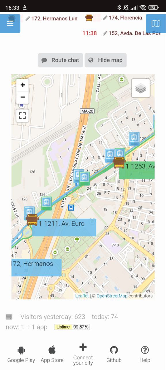
Online map with transport
Bustime application
The application offers the same features as the website.
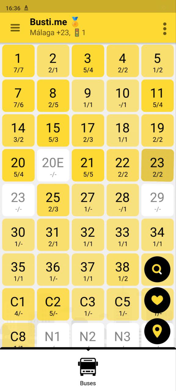
Route grid
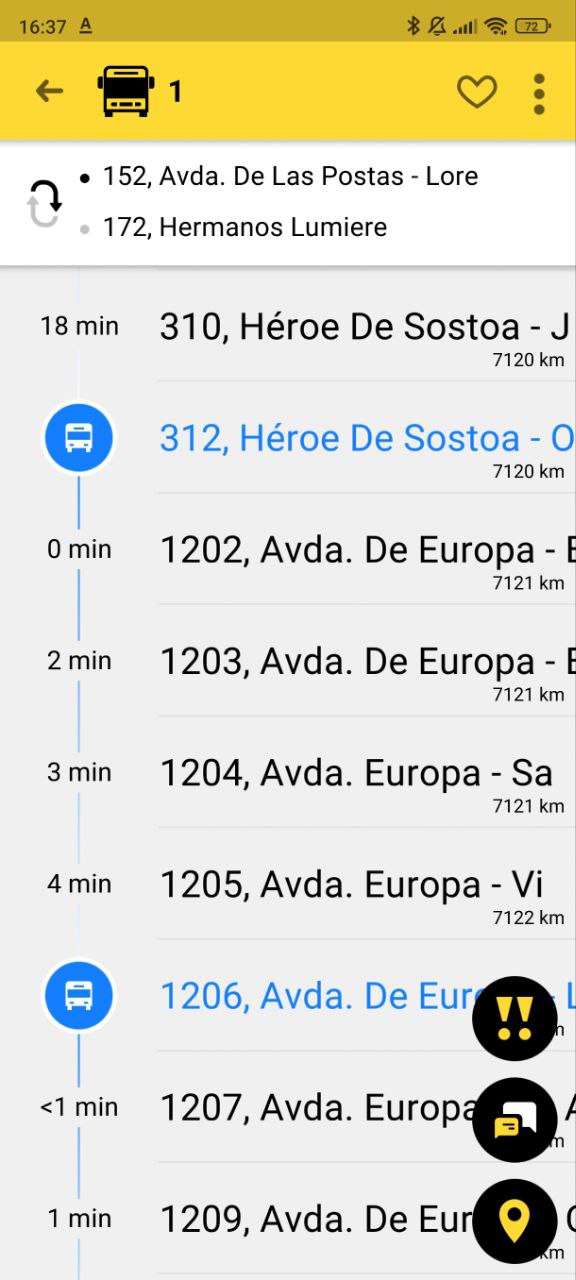
Pleasant route interface
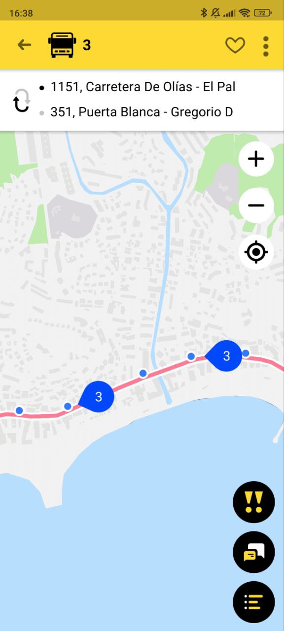
Online map with transport
But besides them, the application has many additional features that make it indispensable:
- It will notify you when the desired stop or bus is approaching.
- Allows you to customize the application interface to your liking.
- Adapted for use by the visually impaired.
- Helps to systematize your favorite buses.
- You can discuss something in the chat.
- Convenient stop board.
- And also small joys: a collection of tickets, a game, a speaker.
Inclusive features

Assistance for the visually impaired
The Bustime app is adapted for use by the visually impaired with the help of VoiceOver and TalkBack technologies (hardware screen reading). Thanks to this feature, the visually impaired can find out where their bus is without external help at stops.
Tracking and notification functions
The application implements the 'Waiting here' feature, allowing you to hear how your bus is approaching and the 'Exiting here' feature, warning about the approach of the stop where you need to exit. Also useful for the visually impaired
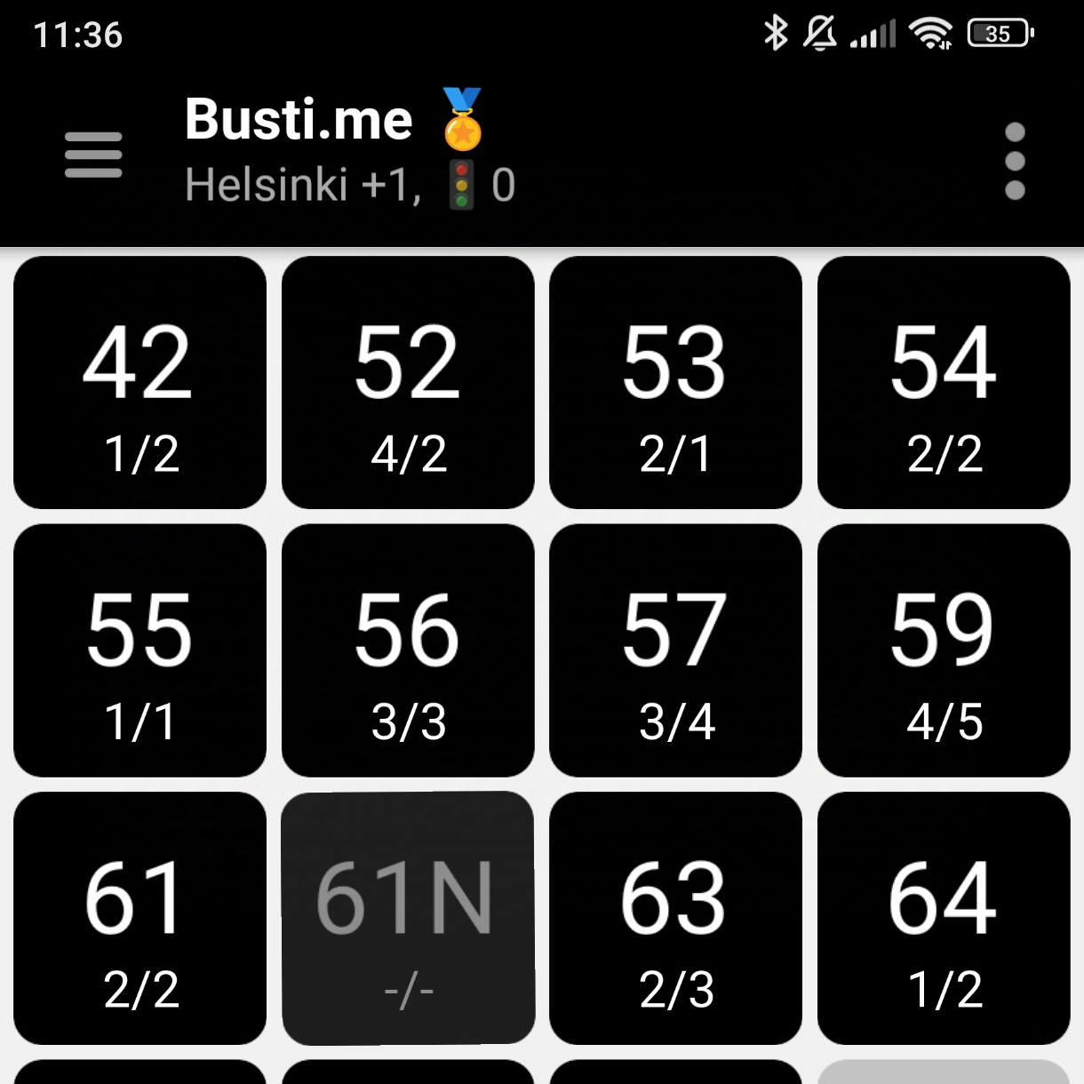
Mode for the visually impaired
We have taken care of visually impaired people who need a high-contrast theme. In this mode, only the most important functionality is left to avoid distractions in perceiving information. The Bustime development team has added the ability to increase the font size so that the content on the application screens does not break, and the reading experience is comfortable.
Special designations for people with limited mobility
Designations for low-floor buses. Local designations for each bus are also provided, which help buses
What else is in Bustime?
In addition to the already listed functionality, there is also:
- Transport data analytics on the site.
- Dispatching and compliance table for cities without dispatchers.
- Driver mode of the application for direct transmission of bus geodata to the server.
Also in the final stage of development:
- Carpooling service.
- Fare search.
In the active phase of development:
- Map with organization search.
User guide
The link to the full user guide is located here


